Map Control Help - Help file
Map Toolbar

The Cariwig portal uses a web mapping platform that allows users to investigate and interact with mapped data. This help document describes the map panel operations.
Each portal map page has the same set of map panel tools. These tools allow the user to navigate the map.
Basemap
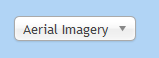
This dropdown allows the user to select their preferred base mapping. The default shows Blue Marble based aerial imagery from Osgeo.org. Currently the user can also select OpenStreetMap data as base mapping.
Zoom to
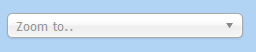
This panel allows the user to position the map to a specific geographical location. You can select from the dropdown or interactively type the location in the search box. Only major islands are listed in this dropdown.
Map controls

The icon bar allows the user to set the map navigation mode and to navigate the map
Home view

The home button takes the user back to the default regional view
Zoom mode

This button changes the mode to “Zoom”. To zoom into the map drag a box whilst depressing the left mouse button. Release the mouse button to zoom in.
On many configurations the mouse wheel can be used to zoom the map in and out as well.
Pan mode

This button allows the user to pan (move) the map. Press and hold the left mouse button whilst moving the mouse in the map panel to pan the map.
Zoom In

zooms the map in by a fixed amount.
Zoom Out

zooms the map out by a fixed amount.
Back view

This button moves the map view back to the previous view if available
Forward Toolbar

This button moves the map to the next view if available
Download Map

A Jpeg version of the current map display can be downloaded for use in reports etc.
Legend

The show legend button shows the legend for the map. To hide the legend select hide legend
Coordinates

The current map coordinates of the cursor are displayed in the bottom right hand corner of the map (WGS84 Longitude/Latitude)
The Cariwig portal uses a web mapping platform that allows users to investigate and interact with mapped data. This help document describes the map panel operations.
Each portal map page has the same set of map panel tools. These tools allow the user to navigate the map.
Basemap
This dropdown allows the user to select their preferred base mapping. The default shows Blue Marble based aerial imagery from Osgeo.org. Currently the user can also select OpenStreetMap data as base mapping.
Zoom to
This panel allows the user to position the map to a specific geographical location. You can select from the dropdown or interactively type the location in the search box. Only major islands are listed in this dropdown.
Map controls
The icon bar allows the user to set the map navigation mode and to navigate the map
Home view
The home button takes the user back to the default regional view
Zoom mode
This button changes the mode to “Zoom”. To zoom into the map drag a box whilst depressing the left mouse button. Release the mouse button to zoom in.
On many configurations the mouse wheel can be used to zoom the map in and out as well.
Pan mode
This button allows the user to pan (move) the map. Press and hold the left mouse button whilst moving the mouse in the map panel to pan the map.
Zoom In
zooms the map in by a fixed amount.
Zoom Out
zooms the map out by a fixed amount.
Back view
This button moves the map view back to the previous view if available
Forward Toolbar
This button moves the map to the next view if available
Download Map
A Jpeg version of the current map display can be downloaded for use in reports etc.
Legend
The show legend button shows the legend for the map. To hide the legend select hide legend
Coordinates
The current map coordinates of the cursor are displayed in the bottom right hand corner of the map (WGS84 Longitude/Latitude)